Introduction
Welcome to the ever-changing geospatial landscape - a world where digital navigation and interactive maps are no longer just a convenience but a necessity. Whether the mission is finding the best Souvlaki in Athens or planning sustainable cities, chances are there's an app to help. And map tiles are often the unsung heroes powering these applications.
The potential applications for map tiles are as vast and boundless as the geography they represent but there are a few things worth considering before you start navigating the world of digital mapping.
So, in this blog, we'll delve into the world of raster and vector map tiles, highlight their differences, and discuss their pros and cons. We'll also shed some light on how we create the best 3D building layer out there and the opportunities this unlocks.
Raster vs. Vector Map Tiles: Understanding the Differences
To understand the differences between raster and vector map tiles, let's take a closer look at each type and their characteristics:
Raster Map Tiles
Raster map tiles, also known as traditional map tiles, are a collection of pre-rendered images that represent specific areas of a map at different zoom levels. Think of these tiles as a jigsaw puzzle made up of images… when you view a map, the raster tiles come together to form the complete picture.
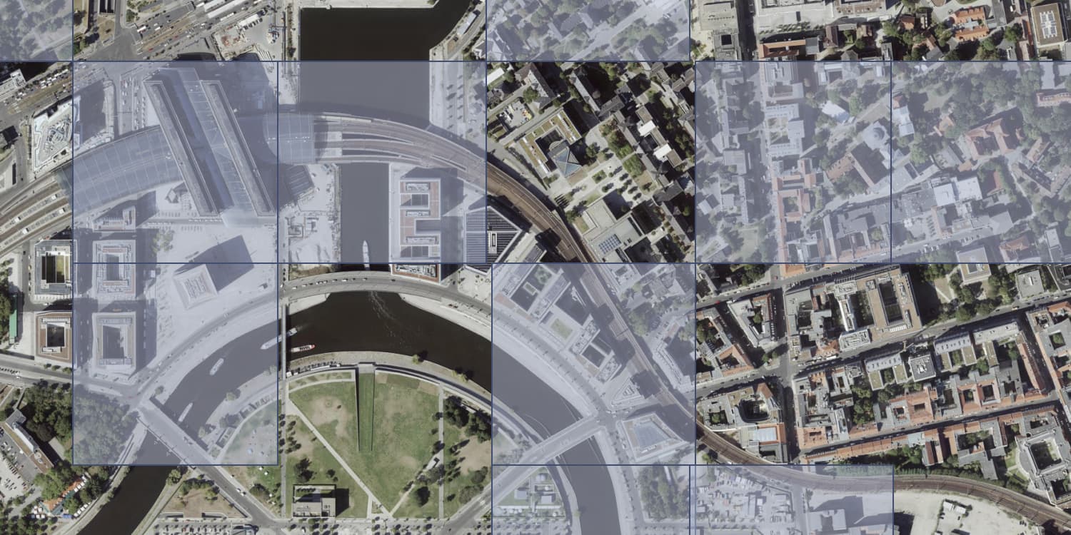
Source: GeoBasis-DE/LGB, dl-de/by-2-0
The main advantages of Raster Map Tiles are:
- Image Quality: One of the most significant advantages of raster map tiles is their ability to display high-quality images. This makes them excellent for detailed visualizations such as aerial imagery or complex terrain like hillshades.
- Easy Processing: Since raster map tiles are pre-rendered, they don't require the user's device to do much processing, making them easier to load and navigate on older or less powerful devices.
However, this approach also has certain limitations:
- Fixed design: Since the images are pre-rendered, it's challenging to modify or interact with individual map elements, like roads, buildings, or labels.
- Pixelation: When you zoom in on a raster map, the images can become pixelated, resulting in a lower quality map.
- Larger file sizes: Raster map tiles can have larger file sizes because the data is stored as images for each zoom level. This can lead to slower loading and increased bandwidth usage.
Vector Map Tiles
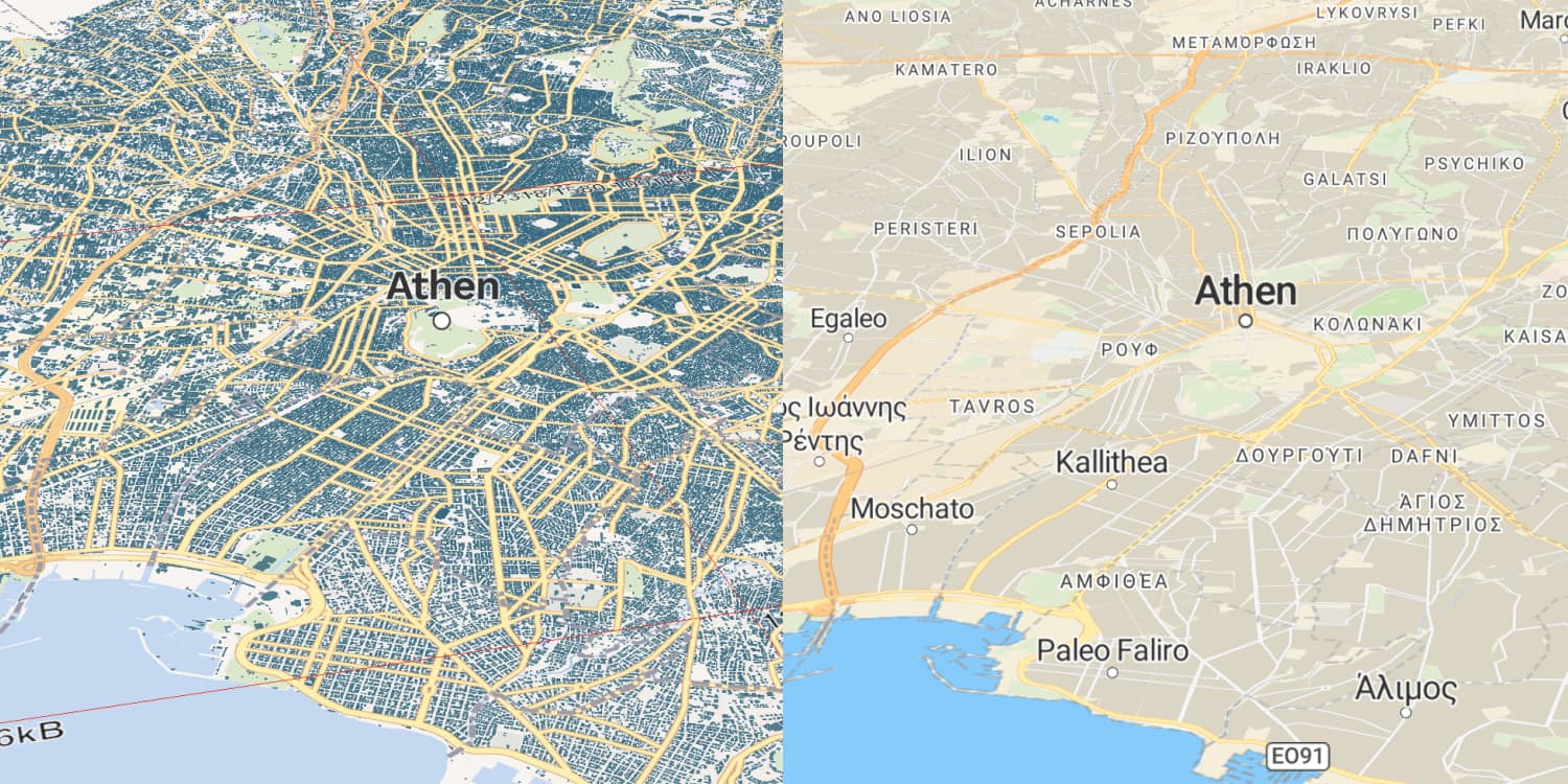
Instead of using pre-rendered images, vector map tiles contain raw geographic data in the form of coordinates and attributes. You can think of this data like a set of instructions that your device uses to draw the map directly. This approach offers several advantages:
- Scalability: Vector map tiles can be easily scaled and rotated without losing quality. As you zoom in or out, the map remains crisp and clear at any level.
- Interactivity: Vector map tiles allow for more interactive maps, as individual elements like roads, buildings, and labels can be easily manipulated or highlighted.
- Customization: Vector maps make it easy to change the appearance of the map by adjusting the styles and colors of different elements, allowing for better branding and custom map designs.
- Smaller file sizes: Storing data as coordinates and attributes generally leads to smaller file sizes compared to raster map tiles, resulting in faster loading times and reduced bandwidth usage.
However, there are also a few drawbacks to vector map tiles:
- Device performance: Vector map tiles require more processing power to render the map on the user's device, which may affect performance on older or resource-limited devices.
- Complexity: Working with vector map tiles can be more complex than raster map tiles, requiring additional programming and styling knowledge to customize and manipulate the map elements.
Despite these drawbacks, vector map tiles are often the preferred choice for many digital mapping applications due to their numerous advantages over raster map tiles.
A Game Changer: ONEGEO Map Tiles are Compatible with Multiple Map Viewers
Our vector map tiles are compatible with a diverse range of map viewers, which truly sets them apart. This adaptability opens up a world of opportunities and benefits:
- Hassle-free integration: Whether your organization is already using a specific map viewer or you're planning to switch, ONEGEO's map tiles are designed to fit right in. Say goodbye to expensive and time-consuming changes to your infrastructure or workflow!
- The power of choice: With compatibility across multiple map viewers, you have the freedom to pick the one that ticks all the boxes for your specific needs. It's all about finding the right viewer with the features and functionality that align with your industry requirements and goals.
- Embrace the future with confidence: As map viewers continue to evolve or new ones hit the market, you can rest easy knowing ONEGEO's map tiles will keep up. This future-proofing aspect not only protects your investment but also keeps your organization nimble in a fast-paced technological world.
- Teamwork made easy: When projects involve multiple teams or organizations, compatibility with various map viewers simplifies collaboration and data sharing. Everyone can work in their preferred map viewer without stressing over data incompatibilities or time-consuming file conversions.
The compatibility with various map viewers empowers you to unlock the full potential of digital mapping with hassle-free integration, greater choice, future-proofing, seamless collaboration, and the ability to leverage unique features for enhanced solutions.
Bringing You the Best Building Layer in Town - How We Do It
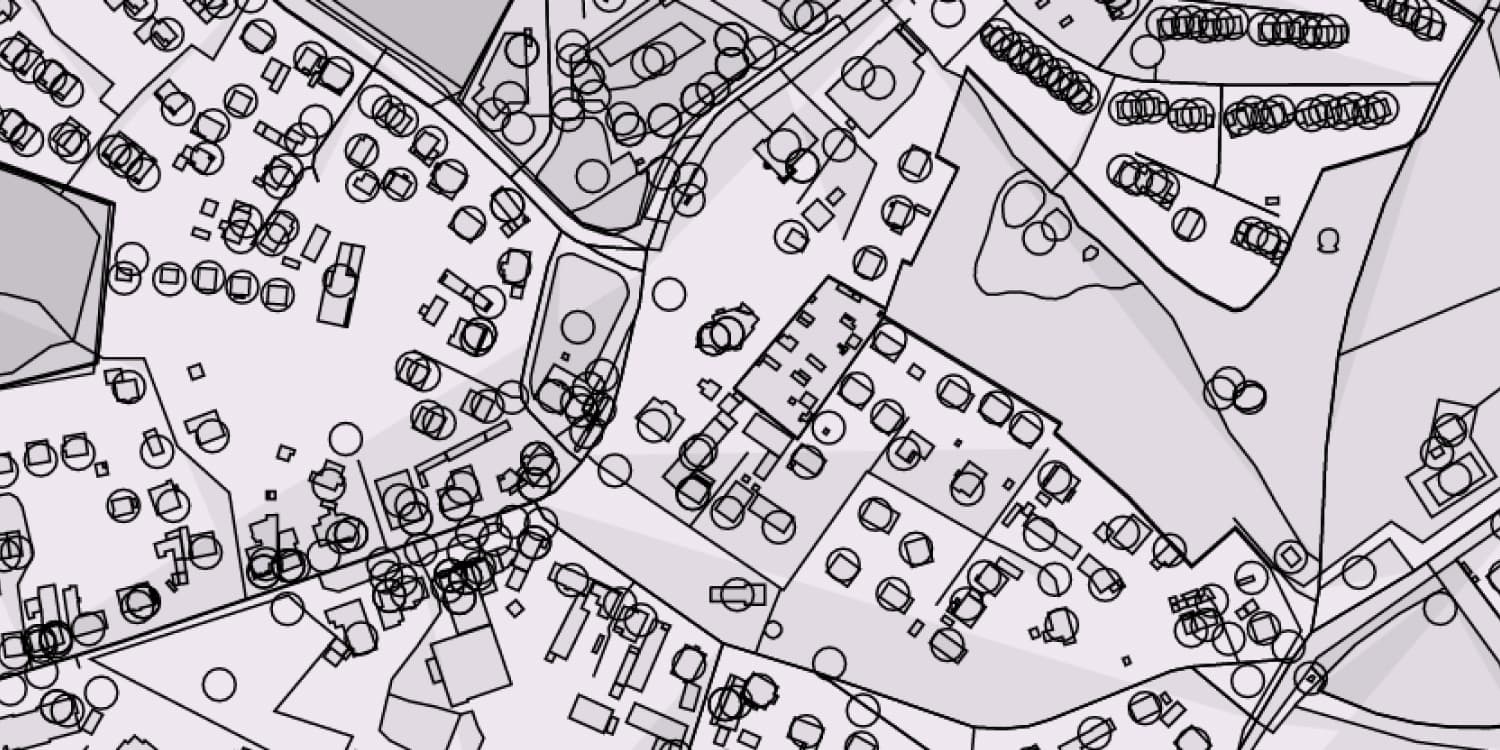
Creating an exceptional 3D building layer begins with collecting two crucial pieces of information about each building: its footprint and its height. These data points set the foundation to construct an accurate and realistic representation of the urban environment.
- Building footprints provide the base outline of every building - the ground plan of the building, showing the overall shape and size as seen from a bird's-eye view
- Height Information adds the third dimension to our building footprints. The height information can come from several sources, like LiDAR data, aerial photogrammetry, or existing databases
These data sources are combined to generate the 3D building layer. Basically, each building footprint is extruded to the height specified by the height data. In other words, the 2D shape is stretched upward, transforming into a 3D object that represents the physical building.
While this might sound straight forward, the process involves meticulous refining and data cleaning as well as rigorous quality checks to ensure the highest level of accuracy and detail in the final 3D building layer.
This innovative process brings cities to life, offering an immersive and intuitive way to explore the built environment like never before. The result is a comprehensive 3D model of the cityscape, ready to revolutionize numerous applications across various industries.
Where Map Tiles Make a Difference: Common Applications
Map tiles form the foundation of digital mapping, powering countless applications across virtually all industries. Here's a glimpse into the typical uses of map tiles:
Navigation and Route Planning is probably the most common use of map tiles. By providing a detailed view of roads, intersections, and landmarks, map and routing applications guide drivers, cyclists, pedestrians, and even autonomous vehicles.
Real estate professionals can elevate their property presentations by integrating map views in their portfolio and showcasing information. Interactive features like highlighting specific properties or customizing visual styles become a breeze and the property details remain crisp and clear at any zoom level, creating a top-notch user experience.

Urban planners, architects, and developers can find vector map tiles with comprehensive building data invaluable. They can analyse existing cityscapes, visualise energy performance, or pinpoint areas for improvement or redevelopment. Vector map tiles offer interactivity and customization, letting planners overlay additional data like population density or public transportation routes for informed decision-making.
Emergency responders are armed with up-to-date building information for better planning and response. They can identify the fastest routes, taking into account building heights and obstacles that may affect navigation. This in combination with data overlays like flood zones or evacuation routes ensures that responders have the most accurate information at hand.
Environmental analysts and sustainability experts can leverage vector map tiles with comprehensive building data to study the impact of urban development on the environment. By overlaying energy performance data on interactive city models, they can identify patterns, trends, and inform urban planning decisions, while developing strategies to boost energy efficiency.
Conclusion
Navigating the digital map-scape has become an intrinsic part of our daily lives and professional operations. From helping us find that perfect Souvlaki spot to planning city-wide energy efficiency strategies, map tiles play a key role in modern mapping applications.
At ONEGEO, we've ventured beyond the conventional and created the market's leading 3D building layer. Because we need to represent the world in three-dimensions to tackle many of today's complex challenges. And as map viewers evolve, we're right there with them, ensuring our map tiles play nice with all major viewers.
If you're ready to try out our augmented open data, get your $50 coupon here.